Enhancing visual hierarchy derived from Pedestrians Requirements for Wayfinding Combining Indoor and Outdoor Environments
In contrast to car drivers pedestrians have a comparatively
bigger locomotion flexibility in terms of the interchange between
indoor and outdoor environment. Due to the difference between the
cognitive processes in indoor and outdoor environment, it is difficult
to find a desired information or point of orientation, e.g. at a
connecting station from a platform of the underground to a bus stop.
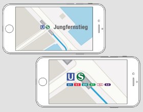
Additionally, in the context of connecting station a large amount of
information is overlaid or the information pedestrians actually need
are not sufficiently visualized in the map. Adapting graphical map
structure to user requirements considering cognitive process represents
a challenge for Location Based Services (LBS) and map design. Several
cartographers have already defined the problem of indoor and outdoor
connection. They utilize indoor infrastructures in an attempt to
enhance the databases thereby calculating and optimizing the route.
However, the graphical information structure combining indoor and
outdoor environment has not jet been sufficiently taken into account.
Taking this issue as a starting point, options were explored as to how
large the amount of signage information is pedestrians actually need
and to what extent the information can be hierarchically visualized and
integrated into a map. The final goal would be the creation of a
graphical structure capable of absorbing a large amount of information
for effective wayfinding combining indoor and outdoor environment.